Hurricane Helene entered Florida as a Category 4 and has since been downgraded to Category 1 with its expected pathway revealed
A Category 4 hurricane struck Florida last night an
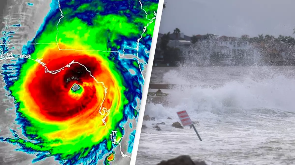
Last night (September 26), Hurricane Helene hit the coast of Florida’s Big Bend in a ‘catastrophic and deadly storm surge’ classified as a Category 4.
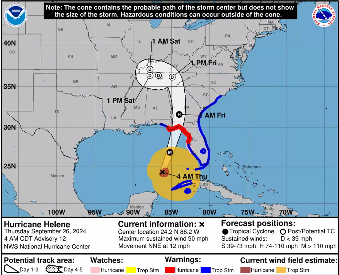
The hurricane has since travelled across the southern region of the state and is making its way towards other states, with its expected path having been mapped out by the National Hurricane Center.
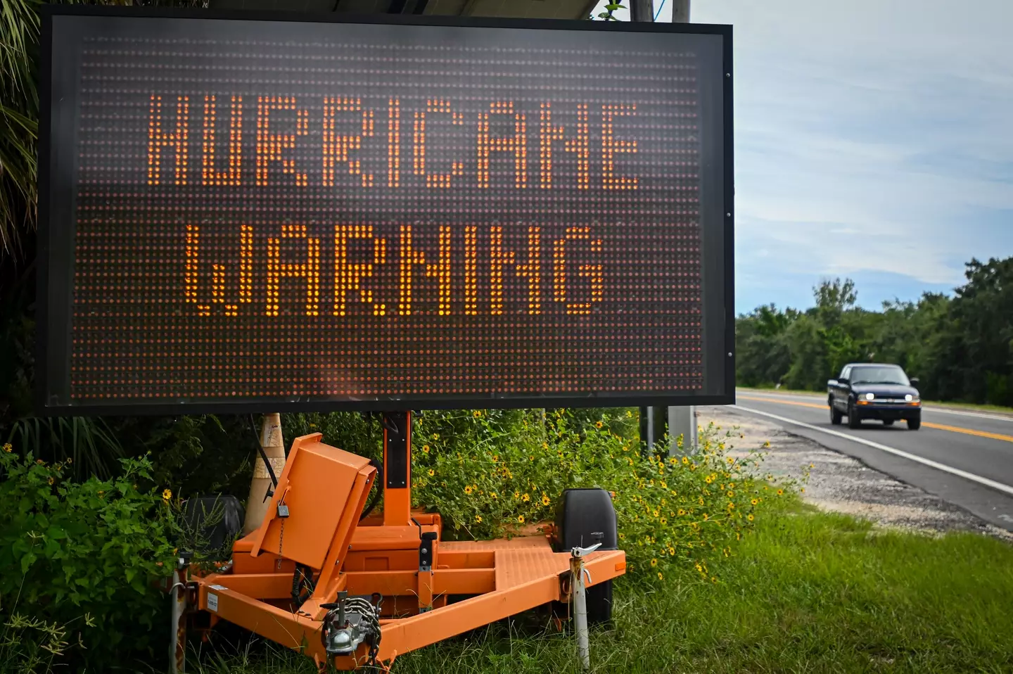
“The risk of impacts from life-threatening storm surge and damaging hurricane-force winds continues to increase along the coast of the Florida Panhandle and the Florida west coast.” they said.
The hurricane entered Florida at around 11:10pm ET on Thursday and it was classified at Category 4, the National Hurricane Center updating: “A NOAA Hurricane Hunter aircraft currently investigating Helene recently found that the maximum sustained winds have increased to 130 mph (215 km/h). The minimum central pressure has also decreased to 947 mb (27.96 inches) based on dropsonde data.”
The Saffir-Simpson Hurricane Wind Scale – which goes from one to five – states a hurricane is Category 4 when it has sustained wind speeds of 130-156 mph.
It continues: “Catastrophic damage will occur: Well-built framed homes can sustain severe damage with loss of most of the roof structure and/or some exterior walls. Most trees will be snapped or uprooted and power poles downed.
“Fallen trees and power poles will isolate residential areas. Power outages will last weeks to possibly months. Most of the area will be uninhabitable for weeks or months.”
Hurricane Helene has since been downgraded to a Category 1 storm – winds of 74-95 mph and considered ‘very dangerous’ producing ‘some damage’ such as to frame homes and ‘extensive damage’ to power lines – and its predicted pathway revealed.
Hurricane Helene’s expected pathway
According to the latest National Hurricane Center updates, the ‘eyewall’ of the hurricane began entering southern Georgia at 1am EDT this morning.
It added: “Helene Weakening as it Moves Quickly North-Northeastward Near Valdosta Georgia. Life-Threatening Storm Surge, Winds, and Heavy Rains Continue.”
By 2am EDT on Friday, Hurricane Helene began moving ‘rapidly north-northeast into southern Georgia’ with maximum sustained winds of 90mph with ‘higher gusts’ and the latest update at the time of writing is ‘Helene [is] Producing Damaging Gusty Winds and Life-Threatening Flooding Over Portions of the Southeast and Southern Appalachians’.
At around 8pm, the hurricane is anticipated as moving into Kentucky before traveling to Tennessee, South Carolina, North Carolina and Alabama.
Georgia Governor Brian Kemp declared a state of emergency yesterday, saying: “The current forecast for Hurricane Helene suggests this storm will impact every part of our state.
“We are not taking anything for granted which is why I have directed appropriate state agencies to work around the clock to ensure we’re prepared for whatever is heading our way,
ABC News reports at least six people have died as a result of the storm.
The National Hurricane Center stated: “This is an extremely dangerous and life-threatening situation. Persons should not leave their shelters and remain in place through the passage of these life-threatening conditions.”
Featured Image Credit: CNN Weather/Joe Raedle / Staff